| | |
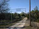
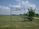
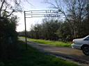
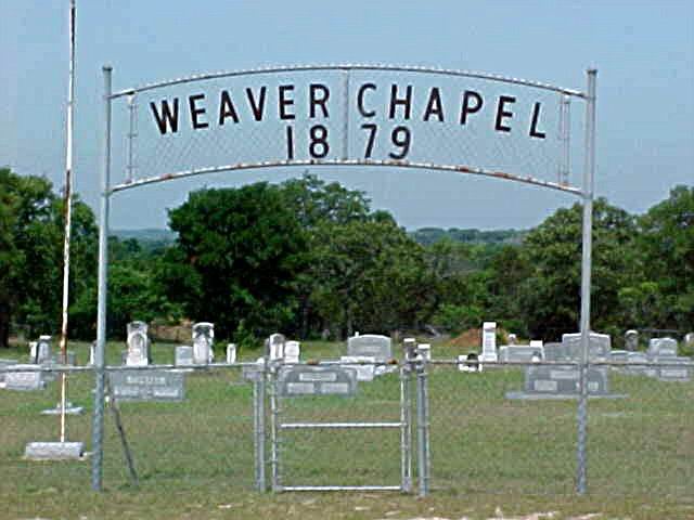
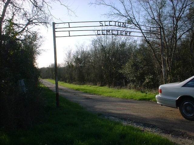
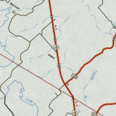
AMES (WEAVER CHAPEL) CEMETERY--Map
Weaver Chapel Cemetery
From
Gatesville take Hwy 36 North for 8 miles. turn left and go 2 miles down
dirt road,
sign
on cemetery. 313148N, 0974924W | 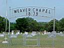 |
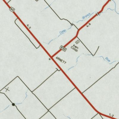
ARNETT CEMETERY--Map
From
Gatesville take Hwy 84 West about 9 miles to junction with FM 930. Turn
right (north) on
FM930, go about 1 mile to a dirt road. Turn right (east) on dirt road andfollow it to cemetery.
312642N-975328W | |
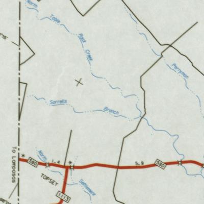
ARNOLD CEMETERY--Map
Located
about 1/2 mile south of Topsey on FM 1113 on the Stoneham place, right
(east) side of
road
behind older home. Enclosed by hurricane fence. 3112.40N 09758.46W
| |
ARROWOOD
CEMETERY--Map
From
Courthouse in Gatesville go 3 miles east on Hwy 84 to Texas Highway Department
complex.
Turn right (south) between 2 red brick houses and go 1 mile in pasture
to cemetery.
Enclosed
in chain link fence. 31.4291763 -97.703964
|  |
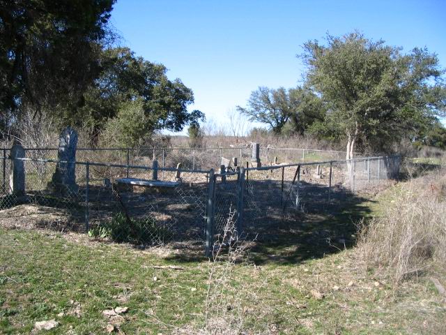
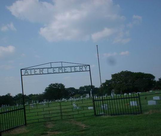
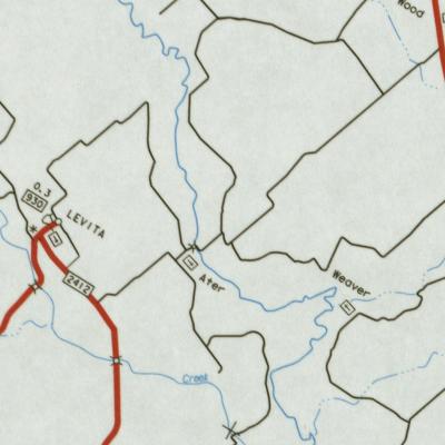
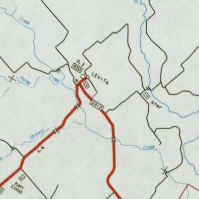
ATER
(aka Sardis) CEMETERY--Map
From
Courthouse in Gatesville take Hwy 84 West to FM 2412. Turn right on 2412
and go ten miles.
After
crossing Plum Creek, turn on first paved road and go north 1 8/10 mile
to cemetery.
On
right side of road at Ater school house. 31.523N 97.861W
|  |
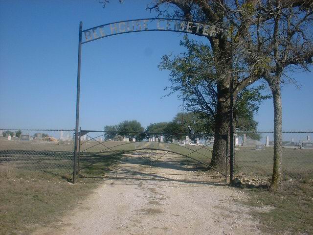
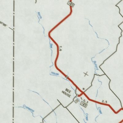
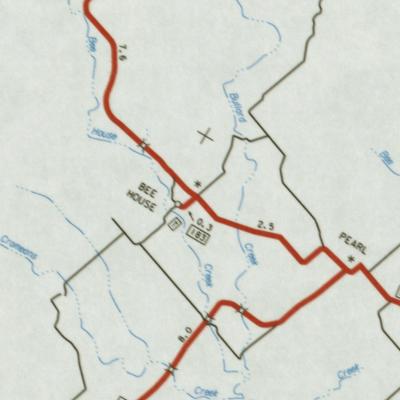
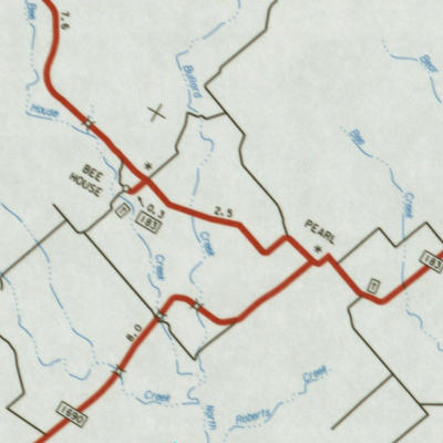
BEE
HOUSE CEMETERY--Map
From
Courthouse in Gatesville take Hwy 84 West 14 miles. Turn left at Purmela
on Spur
183
and go 7 miles through Pearl to Bee House, 3 miles.31.402 98.081W
|  |
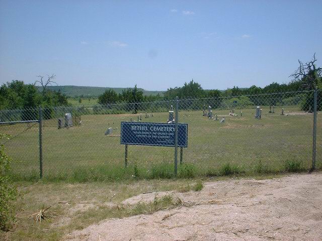
BETHEL
CEMETERY
In
Fort Hood reservation. Contact Range Control, Fort Hood.
|  |
BLACKFOOT
(DAVIDSON) CEMETERY--Map
From
Courthouse in Gatesville, take Hwy 84 East 9 miles to junction with FM
1829. Turn right
(south)
on FM 1829 and go 1 mile to cemetery on right (west) side of road.
312416N 0973650W
| |
BROWN
CEMETERY
Located
on Fort Hood Military Reservation. Contact Range Control, Fort Hood.
| |
BRUCE
CEMETERY
Located
on Fort Hood Military Reservation. Contact Range Control Fort Hood.
| |
CANAAN BAPTISTCEMETERY
From FM 929, take Coryell City Rd north about 2 mi |  |
COFFEY
CEMETERY--Map
From
Courthouse in Gatesville take Hwy 84 East to junction with Hwy 36. Turn
left on Hwy 36
North
and go to junction with FM 929. Turn right on 929 and go approximately
6 miles to an
unmarked
dirt road on left. Turn on this dirt road, go 2 miles, turn left after
crossing dip,
1
mile to cemetery. 313059N 0974210W
| |
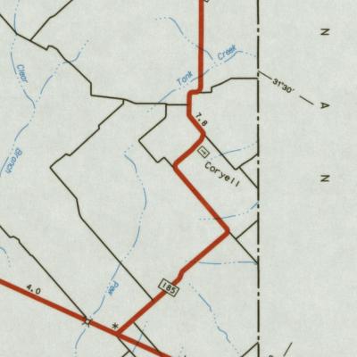
CORYELL
CHURCH CEMETERY--Map
Take
84 East 13 miles from Gatesville, turn left on FM 185 and go four miles
to cemetery
on
right side of road. 31.478N 97.548W
| |
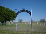
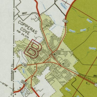
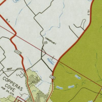
COPPERAS
COVE CITY CEMETERY--Map
Located
on Avenue A, Copperas Cove, Texas. 310736N 0975343W
| |
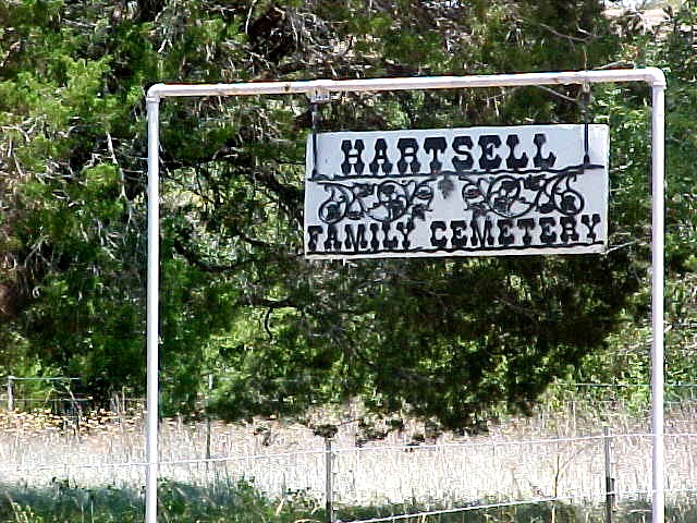
CORYELL
VALLEY CEMETERY aka Hartsell Family Cemetery--Map
From
Courthouse in Gatesville take Hwy 84 East to junction wth Hwy 36 North.
Turn left
on
Hwy 36 North and go to junction with FM 929, turn right on 929 and go approximately
7
miles
to Coryell Valley Church. Turn right at the church and go 3 miles on dirt
road,
cemetery
is on the left side of the road. 312910N 0973849W
|  |
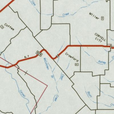
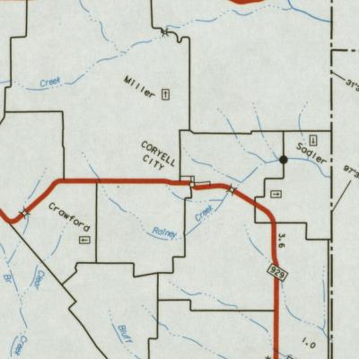
CRAWFORD
CEMETERY--Map
From
the Courthouse in Gatesville take Hwy 84 East to Hwy 36 junction. Turn
left on Hwy 36
and
go to junction with FM 929. Turn right on Fm 929 and go approximately 12
miles toward
Coryell
City to a dirt road. The cemetery is in the pasture about 1 mile east of
FM 929.
There
is no fence or identifying sign. 313126N 0973758W
| |
ELAM
CEMETERY
On
Fort Hood Reservation. See Range Control, Fort Hood.
| |
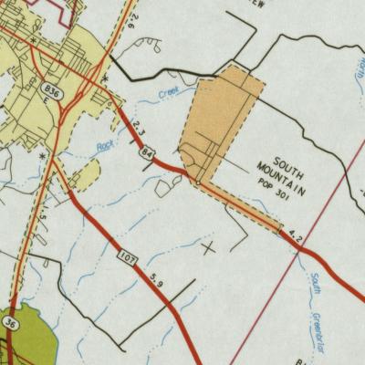
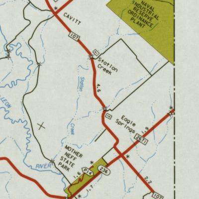
EAGLE
SPRINGS CEMETERY--Map
Take
84 East 14 miles to Oglesby Spur 1996, go 8 miles, turn right on FM 107,
turn left off 107,
go
8 4/10 miles to cemetery. 312101N 0972833W
|  |
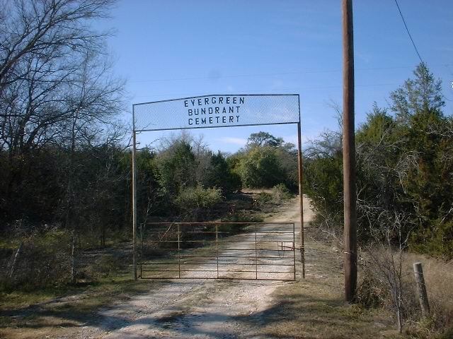
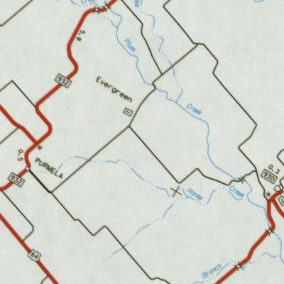
EVERGREEN-BUNDRANT
CEMETERY--Map
From
the Courthouse in Gatesville take Hwy 84 West 14 miles. Turn right (north)
on FM 183 at
Purmela.
Go to post office and turn right. Go 4 miles, keeping left on caliche road
to cemetery on left
of
road 4/10 mile in pasture. 313044N 0975636W
|  |
EWING
(RUTH) CEMETERY
Ruth Cemetery (partial)
On
Fort Hood Military Reservation. See Range Control, Fort Hood.
| |
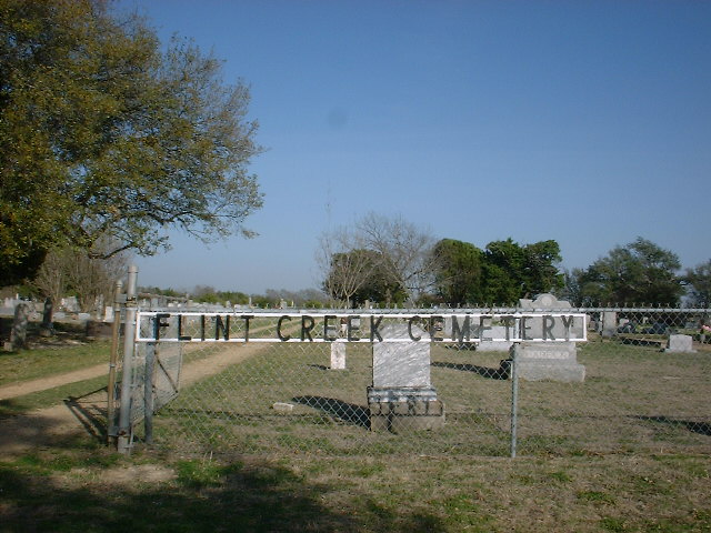
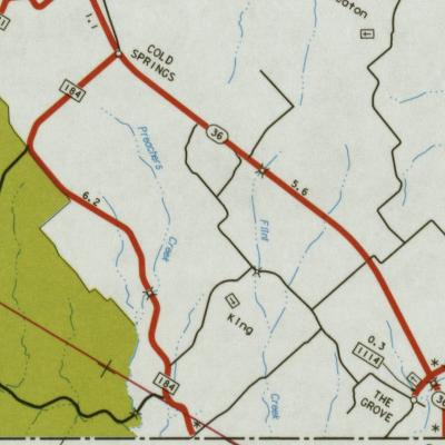
FLINT
CREEK CEMETERY--Map
Alphabetical Listing
TXGenWeb Archives
Creek
From
Courthouse in Gatesville take Hwy 84 East to junction with Hwy 36. Turn
right (south)
on
36 and go to dirt road after you pass Flat and Cold Springs Road (FM 184)
a distance of
13
1/2 miles from Courthouse. Turn right on dirt road and go 3 miles to cemetery.
This map
calls
it King which is an error. 3116.35N 09734.09W
|  |
FORT
GATES-SHERIDAN CEMETERY--Map
From
the Courthouse in Gatesville take Hwy 84 East to the junction with Hwy
36 South,
turn
right. (Temple Highway) Follow Hwy 36 about 5 miles to Fort Gates, turn
left in Fort Gates
and
go 2 miles to the railroad track. Walk south to cemetery down track. Cemetery
is in
Mrs.
Jim Sheridan's pasture behind a locked gate, it is across the road from
Larry Fry home.
312317N
0974103W
| |
FRIENDSHIP
CEMETERY
In
Fort Hood Reservation. Contact Range Control, Fort Hood.
| |
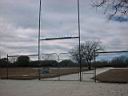
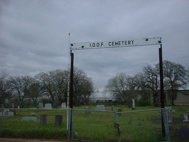
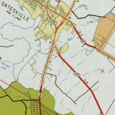
GATESVILLE
CEMETERIES
City
Cemetery, Colored Cemetery, Masonic Cemetery, Oddfellows
and
Restland
are all in the city limits on and off of East Main Street. |  |
GOTCHER
CEMETERY--
Turn left from the parking lot and take FM 1173 towards Topsey.
On the edge of town turn left on Grimes Crossing Road.
Continue straight, Grimes Crossing Rd becomes Bea Powell Road.
Go to end of Bea Powell Road and turn left on Oak Springs Road.
Continue straight .. crossing into Lampasas County on dirt road.
Turn left into 6220 Oak Springs Rd. To the left of the yard there is an access gate to the cemetery.
A path goes around the south side of the cemetery to the metal gate on the east side.
310802N 0975703W
| |
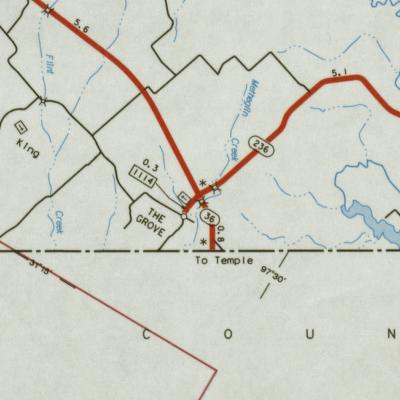
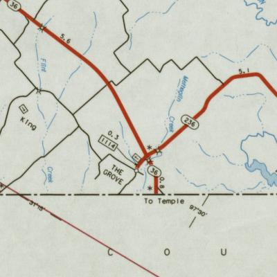
GRAHAM
CEMETERY--Map
From
Gatesville go about 19 miles south on Hwy 36 to The Grove, turn left on
Hwy 236.
Cemetery
is about 1 mile from the intersection on the right. 311735N
0973115W
Offsite Find-A-Grave lists a few headstones.
| |
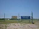
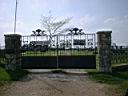
| GRAHAM RANCH CEMETERY-- and NEW GRAHAM CEMETERY were located in an area on either side of the intersections ofCowhouse Creek and Brown's Creek which is now inside Fort Hood. Graham Ranch Cemetery graves were movedoutside of Fort Hood. For more information, see the Coryell County Cemetery Archives. | |
GREENBRIAR
CEMETERY--
From
Courthouse in Gatesville take Hwy 84 East to Mountain Road. Turn left on
Mountain Road,
go
2 miles to Mountain Church. Take a right at the church and go 3 miles to
the cemetery,
on
left side of the road. 312623N 0973803W
|  |
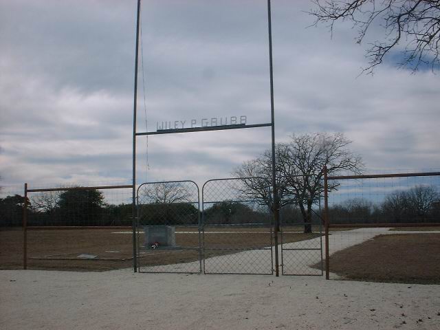
GRUBB
CEMETERY--Map
Grubb Cemetery
See
Wiley Grubb Cemetery
|  |
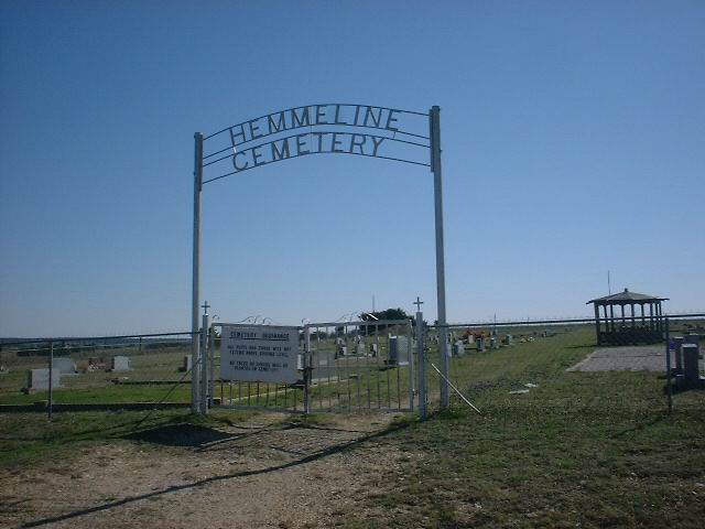
HEMMELINECEMETERY--
From the court house in Gatesville,Tx. follow U.S.Hwy.84 West,5.8 miles to CR 136
Turn to the left on CR 136(South) for 1.7 miles to the Cemetery
Its at the intersection ofCR136 and CR127. | 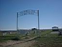 |
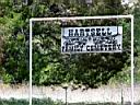
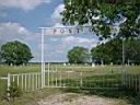
HIGGINS
CEMETERY--Map
Higgins, Sheridan and Heartsell Cemeteries
Located
one mile south of Bee House on left side of the road, just south of North
Bee House Creek.
31
2402N 98 488W
| |
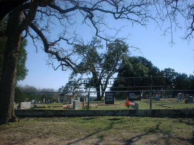
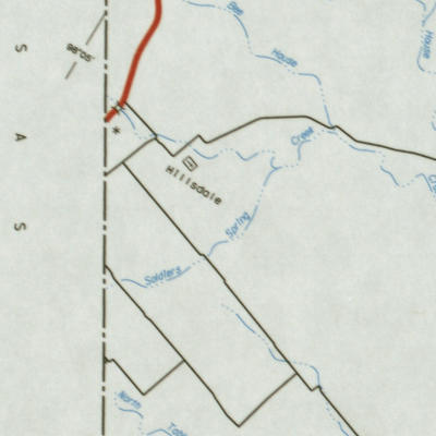
HILLSDALE
CEMETERY--Map
From
Courthouse go west on Hwy 84 to junction with FM 116, turn left on 116
and proceed south
about
2.7 miles. Turn right on FM 1783 and follow it about 16-17 miles to cemetery
on left (south)
side
of the road. 311832N 0980305W
|  |
HOPE
CEMETERY--Map
From
Courthouse take Hwy 84 west about 14 miles to Purmela. In Purmela turn
left (south) on
FM
183 and go about 9 miles to second house on right after passing Pearl Cemetery.
Enter
gate
at barn and go 1 mile in pasture to cemetery.
| |
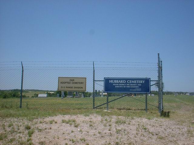
HUBBARD
CEMETERY
On
Fort Hood Military Reservation. Contact Range Control, Ft. Hood.
|  |
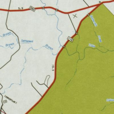
IMMANUEL
LUTHERAN CHURCH CEMETERY--Map
Immanuel
Lutheran Cemetery
From
Courthouse take Hwy 84 West to junction with FM 116. Turn left (south)
on 116 and go
25
miles toward Copperas Cove. Turn right at sign (Immanuel Lutheran Church)
and go 3 miles to
cemetery.
311021N 0975347W
| |
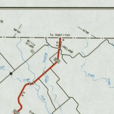
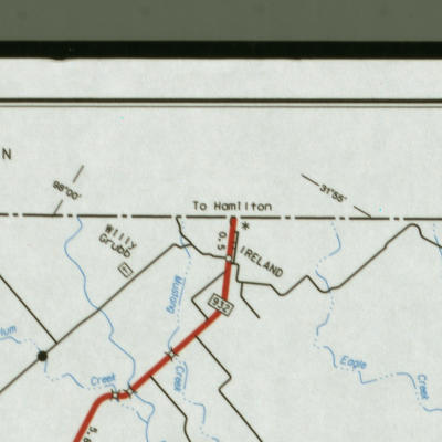
IRELAND
CEMETERY--Map
From
Courthouse in Gatesville take Hwy 84 west about 14 miles to Purmela. In
Purmela turn
right
on FM 932 north and go 7 miles to Ireland. Turn left (west) at store on
182 and go about
3
miles to a junction, take 185 to cemetery. 3132210N 0975754W
|  |
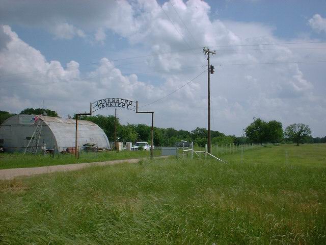
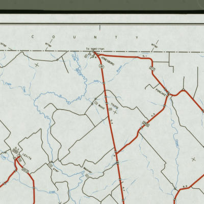
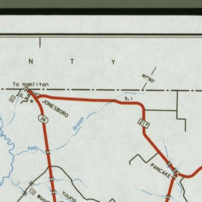
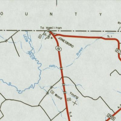
JONESBORO
CEMETERY--Map
Jonesboro
Cemetery
In
town of Jonesboro, near Leon River on the south side of Hwy 36.316170N
9787315W
|  |
KELLY
CEMETERY
Kelly and Powell Cemeteries
Located
on private property near Jonesboro. Permission must be obtained.
| |
KING
CEMETERY--Map
From
Courthouse in Gatesville take Hwy 84 west to junction with Hwy 116. Turn
left (south)
and
follow 116 to junction with FM 1783, about 3 miles. Turn right (west) and
follow FM 1783
about
3 miles. Turn right (west) and followFM 1783 about 7 miles to cemetery
on the right just
past
King Baptist Church. 311621N 0973405W
|  |
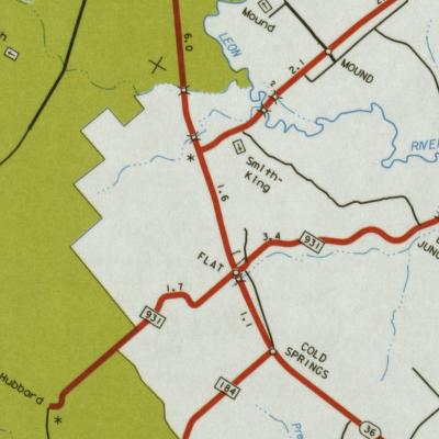
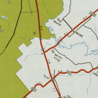
KING-SMITH
CEMETERY--Map
King-Smith
Cemetery
from
Courthouse in Gatesville take Hwy 84 East to junction with Hwy 36. Follow
Hwy 36 South
to
junction with FM 1829 (Mound road). Turn left (north) on fM 1829 and go
about 4/10 mile to
cemetery
on right side of road. 311942N 0973845W
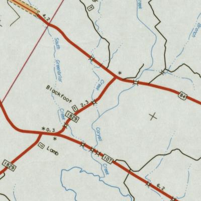
LAMB
CEMETERY--Map
From
Courthouse in Gatesville take Hwy 84 East to the junction with Hwy 36 south.
Take 36
south
to FM 107, turn left (east) and follow 107 to FM 1829 (Mound road). Turn
right (south) on
FM
1829 and follow it to cemetery (about 9 miles from Courthouse). The cemetery
is just past the
Shelburne
Ranch entrance. 312303N 0973720 W
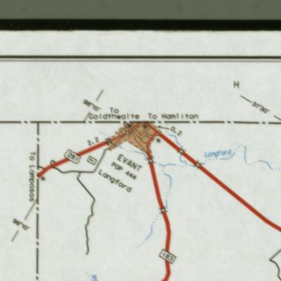
| | LANDFORD,
LANGFORD or LANKFORD CEMETERY--Map
From
Courthouse in Gatesville take Hwy 84 west to Evant. Turn left and go past
the school house.
Take
the first left and go 1 mile to the cemetery (on the right).
312747N
0980920W
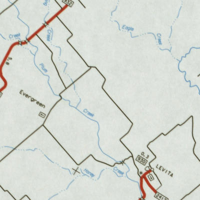
| | LEVITA
CEMETERY--Map
Levita
Cemetery
From
Courthouse in Gatesville take Hwy 84 west about 9 miles to junction with
FM 930. Turn
right
(north) on FM 930 and go about 4.6 miles to cemetery on right (east) side
of road.
313053N
0975316W
|  | LOGAN
CEMETERY--Map
Located
in a pasture at Raymond and Iva Lee Barton Sims. The gate is locked. Take
Hwy 84 east
5
miles to Mountain store. Turn left and go 2 miles to Primitive friendship
Baptist Church. Turn
right
and go 3/10 miles to first house on left (north) side of road. The cemetery
was chain link
fenced
several years ago by descendants.31 2708N 97 40.61W
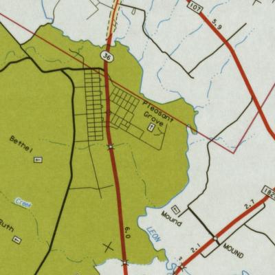
| | | McCarverCEMETERY-- |  | MOUND
CEMETERY--Map
Mound
Cemetery
From
Courthouse take Hwy 84 East to junction with Hwy 36. Turn right (south)
on 36 and go to FM 1829,
about
9 miles. Turn left on FM 1829 and go 1 1/2 miles to Mound store and turn
left. Go 7/10 mile
then
turn left and go 3/10 mile to cemetery.312103N 0973908W | |
| MURPHEE
CEMETERY (Hamilton Co.) | |
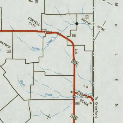
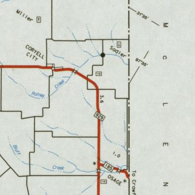
OSAGE
CEMETERY--Map
From
Courthouse take Hwy 84 East to junction with Hwy 36 North. Turn left on
36 and go to
FM
929 (2 miles from Courthouse). Turn right on 929 and go 14 7/10 miles,
turn on FM 185 and
go
about 3/10 mile to cemetery. 313101N 0973415W
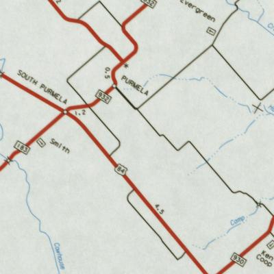
| | PEARL
CEMETERY--Map
from
Courthouse take Hwy 84 West approximately 14 miles to junction with FM
183. Turn left
(south)
on 183 and follow it about 7 miles to cemetery on right.312436N 0980205W
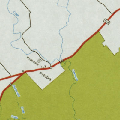
|  | PIDCOKE
CEMETERY--Map
From
the Courthouse take Hwy 84 West to junction with FM 116, about 2 miles.
Turn left (south) on
116
and follow it to Pidcoke, about 14 miles. Turn right (west) in Pidcoke
and go approximately 7/10
mile
to cemetery. 311650N0 975351W
|  | PLEASANT
GROVE (CUMMINGS) CEMETERY--Map
From
the Courthouse take Hwy 84 East to the junction with Hwy 36 South. Follow
Hwy 37 South
about
6 miles, turn left (east) and go approximately 2 miles to cemetery.312210N
0974017W
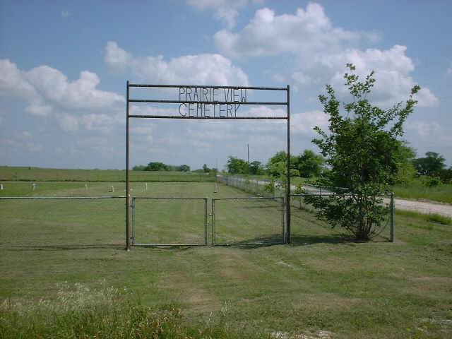
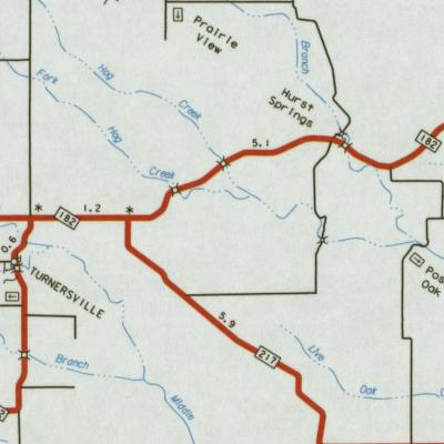
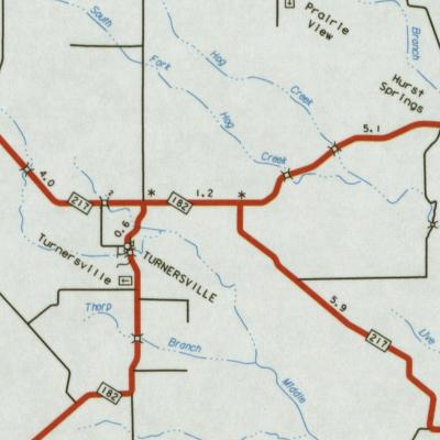
|  | PRAIRIE
VIEW CEMETERY--Map
From
the Courthouse take Hwy 84 East to the junction with Hwy 36 North. Continue
on Hwy 36
North
until junction with FM 182. (Turnersville road) Turn right (north) on HWY
182, about 10
miles
to Turnersville, continue on Hwy 182 past Turnersville about 6 1/2 miles.
Take a left
off
182, cross Hurst Springs Branch. Take the first left off that road and
go about 2 miles to
the
cemetery on the left (south).314014N 0974419W
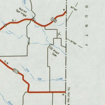
|  | POST
OAK, HURST SPRINGS COMMUNITY CEMETERY--Map
From
Gatesville go through Turnersville on HWY 182, past Hurst Springs Branch
about 1 mile,
take
right and go until it dead ends, turn right and continue about 1 mile,
cemetery will be on
left.
312247N 0973128W
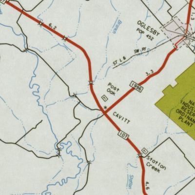
|  | POST
OAK, OGLESBY CEMETERY--Map
Post
Oak Cemetery-Oglesby
From
Courthouse take HWY 84 East to Oglesby Spur. Turn right (south) on Spur,
FM 1996
and
go 4 miles, cemetery will be on the right.
|  | POWELL-FLETCHER-LANE
CEMETERY--Map
Located
in Ft.Gates east of HWY 36 behind Jack and Patsy Martin Fry's home place.
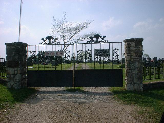
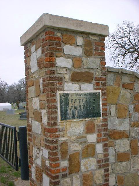
| | RESTLAND
CEMETERY
Restland Cemetery
See
Gatesville
|  | RAINEY
CEMETERY--Map
Hurst
Springs community, northeastern part of county on Boyd Cheatham's farm.
Almost
inaccessible by car.
| | RUTH
(EWING) CEMETERY
See
EWING
| | SADLER
CEMETERY--Map
Sadler Cemetery
Take
HWY 36 North to FM 929. Turn right on 929 and continue to Coryell City.
Turn left (northwest)
on
dirt road, go 1 mile and take first road to the right. Go 2 miles and cemetery
is on right (east).
313411N
0973553W
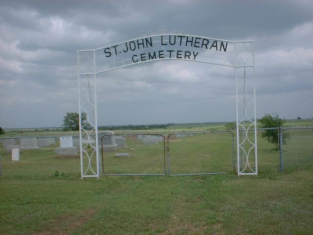
| | SAINT
JOHN LUTHERAN CHURCH CEMETERY--Map
Take
HWY 36 North to junction with FM 929 and go to Coryell City. Go past store
and cemetery
will
be on the left by the Church.
| 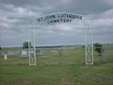 | SAINT
PAUL LUTHERAN CHURCH CEMETERY--Map
At
THE GROVE. From Courthouse take 84 East to junction with 36 South, follow
36 South to
FM
1114, approximately 13 1/2 miles. Turn right on FM 1114 and go 2/10 mile
to Saint Paul
Lutheran
Church. Turn right and go through Church yard and gate behind Church to
cemetery,
about
8/10 mile, on the right. 313302N 0973606W
| | SAUNDERS
CEMETERY--Map
On
Saunders Ranch, northwest of Gatesville, on the Moccasin Bend road which
feeds into FM 2412
on
the right about a mile from the junction.
| | SEATON
CEMETERY--Map
From
Courthouse take 84 East to junction with 36 South, take 36 South to Flat,
about 12 miles, turn
left
(north) on FM 931 and go about 3 miles to Leon Junction. Go past store
and bear right, the
cemetery
will be on the right about 3 miles.
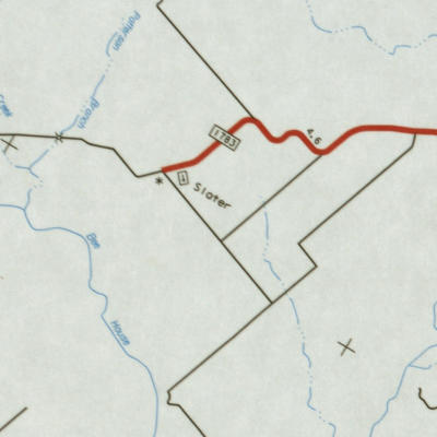
|  | SLATER
CEMETERY--Map
From
the Courthouse take HWY 84 West to junction with FM 116, turn left (south)
on 116 ond follow
to
its junction with FM 1783, about 3 miles. Turn right (west) on FM 1783
amd continue about 12
miles
to the cemetery which is on the left (east) side of the road. No name on
entrance.31.343N 97969W
|  | SMITH
CEMETERY--Map
Smith
Cemetery
From
Courthouse take 84 West to Purmela, 13-14 miles. Turn left (south) on FM
183 and go
about
7/10 mile to the cemetery on the left (east) side, has a sign.
| | SMITH-KING
CEMETERY
See
King-Smith.
| | SPRING
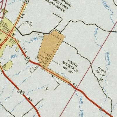
HILL CEMETERY
On
Ft. Hood reservation, see Range Control.
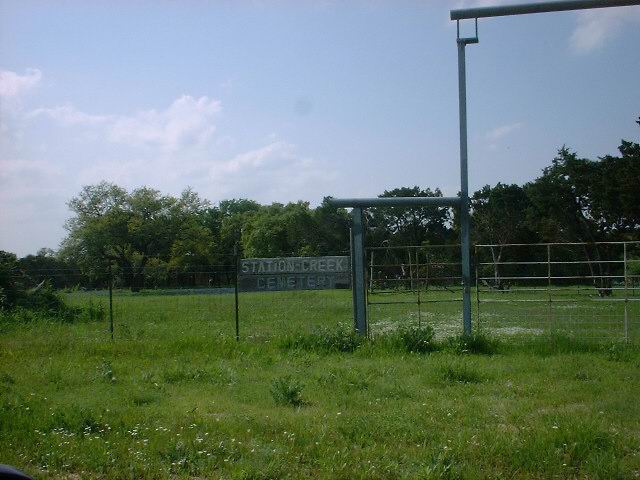
| | STATION
CREEK CEMETERY--Map
From
Courthouse take 84 East 14 miles to Oglesby Spur, FM 1996. Turn right on
FM 1996 and
go
4 miles past Post Oak Cemetery to FM 107. Turn left on FM 107 and go 2
miles to Station
Creek
Cemetery on a small road to the left just past Station Creek. 312213N 0972938W
|  | SYCAMORE
CEMETERY--Map
Located
in a pasture about 3 miles west of Levita, about 14 miles from Gatesville.
The gate
is
locked and we are investigating access with the new owners
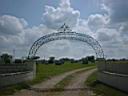
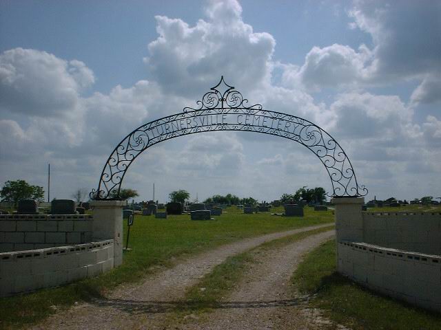
| | TURNERSVILLE
CEMETERY--Map
From
Courthouse take Hwy 84 East to Hwy 36 (north) junction. Continue on Hwy
36 to junction with
FM
182. Turn right (north) on FM 182 and continue about 8 miles to the cemetery
on the left.
Has
a sign. 313639N 0974400W
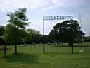
|  | UNION
VALLEY CEMETERY--Map
Union
Valley Cemetery
Union
Valley Cemetery is accessible from Hwy 116 now. From Gatesville, go south
on Farm
Road
116 for about 9 miles to Vista Road. There is a State Hwy sign "Union Valley
Cemetery"
indicating
to turn right on Vista Road. Go to the end of Vista Road; through the gate
onto private
property
(a sign gives permission); proceed on the gravel road to the cemetery gate.
31
20.658N 09752.679W
From
the Courthouse take Hwy 84 West to junction with FM 117, 2 miles. Turn
Left (south)
and
follow 116 to the first dirt road on the right after going down Hard Bargain
Mountain which
gives
one a panoramic view of the Cowhouse Creek Valley. Turn right on dirt road
and go about
1.2
miles to a gate on the left (south) side of the road. Turn left (south)
and follow road in
pasture
about 1/2 mile to the cemetery. Contact George Patterson, Gatesville, Union
Valley
Cemetery
Association President, on how to get key to locked gate to pasture.
|  | WALKER
CEMETERY
On
Fort Hood Military Reservation, see Range Control.
| | WARREN-MILLER
CEMETERY--Map
From
Courthouse take Hwy 84 East to Hwy 36 North, turn left on Hwy 36 and go
to FM 929.
Turn
right on FM 929 and go about 14 miles to Coryell City, turn left to the
northwest and go
about
2 miles to the cemetery.
| | WEAVER
CHAPEL CEMETERY
See
AMES
WEAVER'S
BEND a.k.a. MURRELL--Map
On
Billy Pruitt's land south of Wood Cemetery which is south of Hwy 36 near
Jonesboro,
and
east of Jonesboro on unnumbered road. It will be near the Leon River.313123N
0975139W
| | WILEY
GRUBB CEMETERY--Map
Grubb Cemetery
From
Courthouse in Gatesville take Hwy 84 west about 14 miles to Purmela. Turn
right on FM 932
north
and go 7 miles to Ireland. Turn left (west) on 182 and go about 3 miles
to Grubb Cemetery
on
right. 31.552N 97.979W
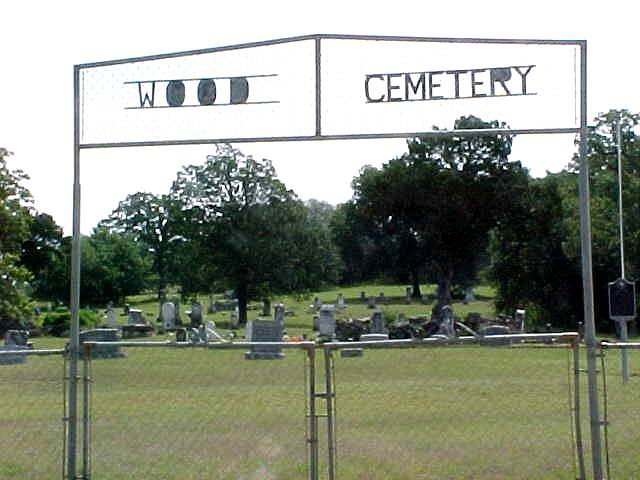
| | WOOD
CEMETERY--Map
Wood
Cemetery
From
Gatesville go Hwy 36 North toward Jonesboro 12 miles. Turn left on unnumbered
road
and go about a mile south to the cemetery which is on the left side of
the road (east).
| 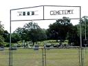 | YOUNG
CEMETERY--Map
On
Hwy 36 to Jonesboro, before the Wood cemetery turn off, is on the right
side of the road.
313459N
0975008W. From Coryell County Family History book with permission. | | | |


